Project Highlights:
- Conducted needs assessment, migration, and implementation of computerized maintenance management system (CMMS)
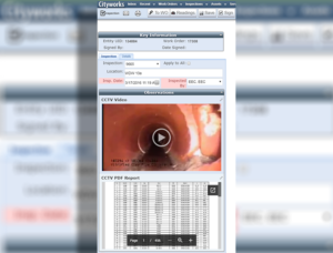
- Implemented mobile data acquisition capabilities
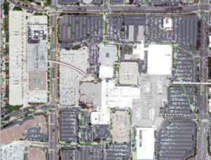
- Implemented geographic information system (GIS) server and associated support services
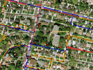
- Developed, edited, and maintained geodatabase
- Created automated feature classes development
- Implemented and updated software
- Developed graphical user interface and custom tools
- Migrated large data inventory
- Provide on-site GIS technical support
EEC Environmental (EEC) has provided GIS services to a City Water Resources Division since 2004. EEC guided the division in transitioning from computer-aided drafting (CAD)–based data management to a GIS-based system. To enable the City to take full advantage of its investment, EEC analyzed the actual use of the GIS and GIS-based technologies and helped the City acquire and implement new GIS technologies that enable greater user efficiency.
In response to the City’s need to efficiently store and analyze decades of historical maintenance data, EEC developed a GIS-based database and data-entry procedure to transfer data from old, hand-marked water service index cards to digital data complete with GIS representations. The digital data can now be queried and analyzed in the GIS. EEC has also assisted the City in creating GIS feature classes based on existing tabular data using largely automated methods, thereby reducing the manual effort necessary to create asset representations in GIS. In addition, EEC created custom tools and a user interface to help the City manage inspections and noncompliance issues for food service establishments.
In 2010, EEC assessed the City’s need for automated software to manage workflow and assets across its various operations groups. EEC identified a software solution and began implementing a GIS-based CMMS. The implementation phase for the CMMS is nearing completion and the City is considering further expansion of the system to other groups.
In addition, EEC is currently facilitating the implementation of multiple mobile data acquisition and maintenance management systems for the City. These systems allow staff to digitally view and collect GIS and CMMS data from the field and synchronize that data with a central database, eliminating the burden of paper-based workflows.